File:FrontierChart2.png: Difference between revisions
Jump to navigation
Jump to search
No edit summary |
Studenterhue (talk | contribs) Add file description |
||
| (One intermediate revision by the same user not shown) | |||
| Line 1: | Line 1: | ||
A map of the planets, moons, and other celestial bodies within SS13's planetary system, presented as an in-universe orbital chart. This is part 2 of 5, showing the Main Rings District. | |||
[[Category:Lore Images]] | |||
Latest revision as of 08:24, 21 October 2023
A map of the planets, moons, and other celestial bodies within SS13's planetary system, presented as an in-universe orbital chart. This is part 2 of 5, showing the Main Rings District.
File history
Click on a date/time to view the file as it appeared at that time.
| Date/Time | Thumbnail | Dimensions | User | Comment | |
|---|---|---|---|---|---|
| current | 20:30, 6 October 2022 | 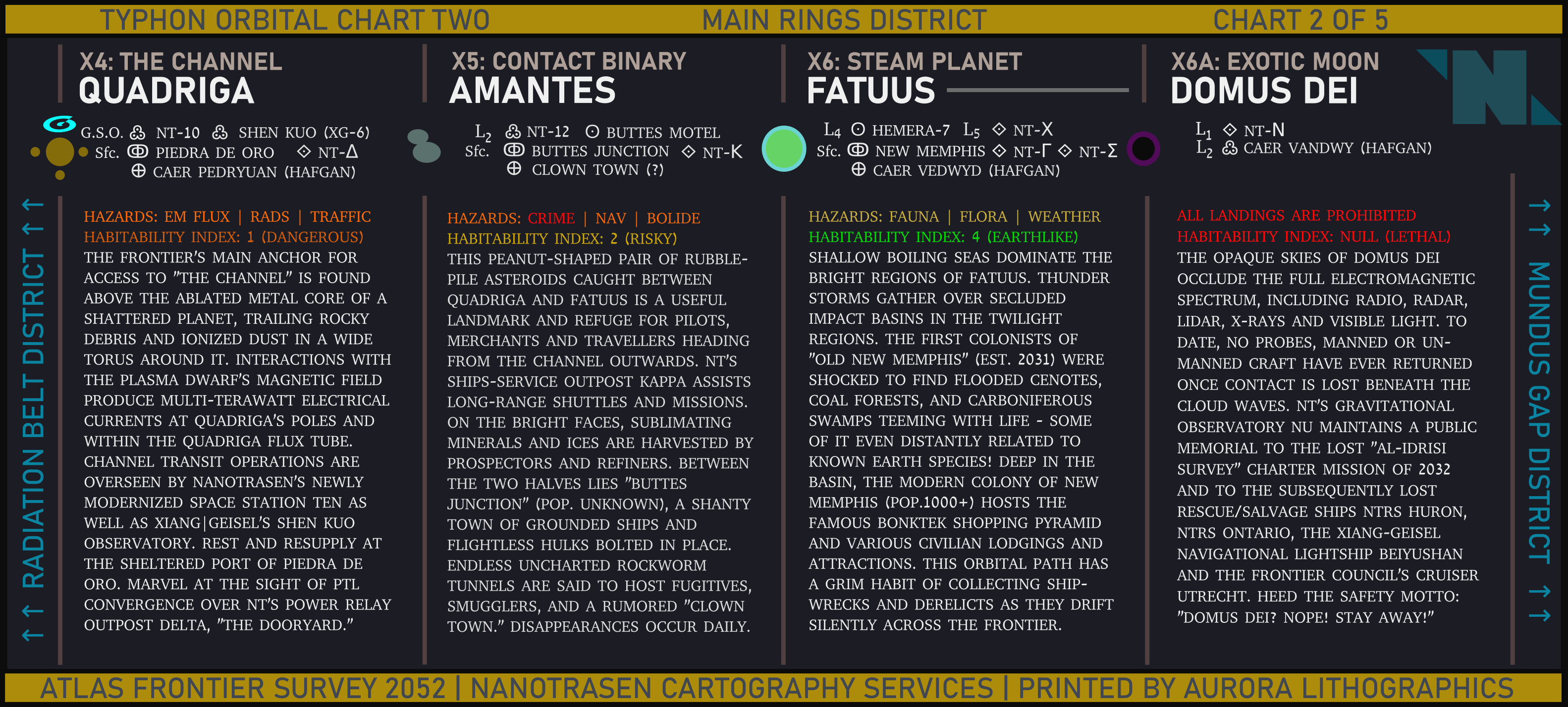 | 3,165 × 1,428 (1.34 MB) | Cogwerks (talk | contribs) |
You cannot overwrite this file.
File usage
The following page uses this file: