Difference between revisions of "File:FrontierChart5.png"
Jump to navigation
Jump to search
Studenterhue (talk | contribs) m (Assign to Lore Images, since this is a guide to SS13's planetary system being presented as an orbital chart from within the game's world) |
Studenterhue (talk | contribs) (Add file description) |
||
| Line 1: | Line 1: | ||
A map of the planets, moons, and other celestial bodies within SS13's planetary system, presented as an in-universe orbital chart. This is part 5 of 5, showing the Niflheim District, plus two nearby stars. Presumably should not be confused with the NFLheim District. | |||
[[Category:Lore Images]] | [[Category:Lore Images]] | ||
Latest revision as of 08:29, 21 October 2023
A map of the planets, moons, and other celestial bodies within SS13's planetary system, presented as an in-universe orbital chart. This is part 5 of 5, showing the Niflheim District, plus two nearby stars. Presumably should not be confused with the NFLheim District.
File history
Click on a date/time to view the file as it appeared at that time.
| Date/Time | Thumbnail | Dimensions | User | Comment | |
|---|---|---|---|---|---|
| current | 20:31, 6 October 2022 | 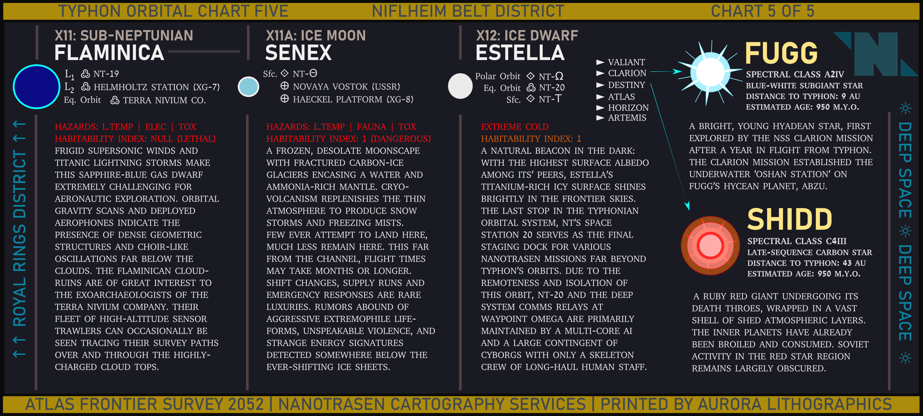 | 3,167 × 1,428 (1.14 MB) | Cogwerks (talk | contribs) |
You cannot overwrite this file.
File usage
The following page uses this file: