File:FrontierChart1.png
Jump to navigation
Jump to search
Size of this preview: 800 × 361 pixels. Other resolution: 3,168 × 1,428 pixels.
Original file (3,168 × 1,428 pixels, file size: 1.3 MB, MIME type: image/png)
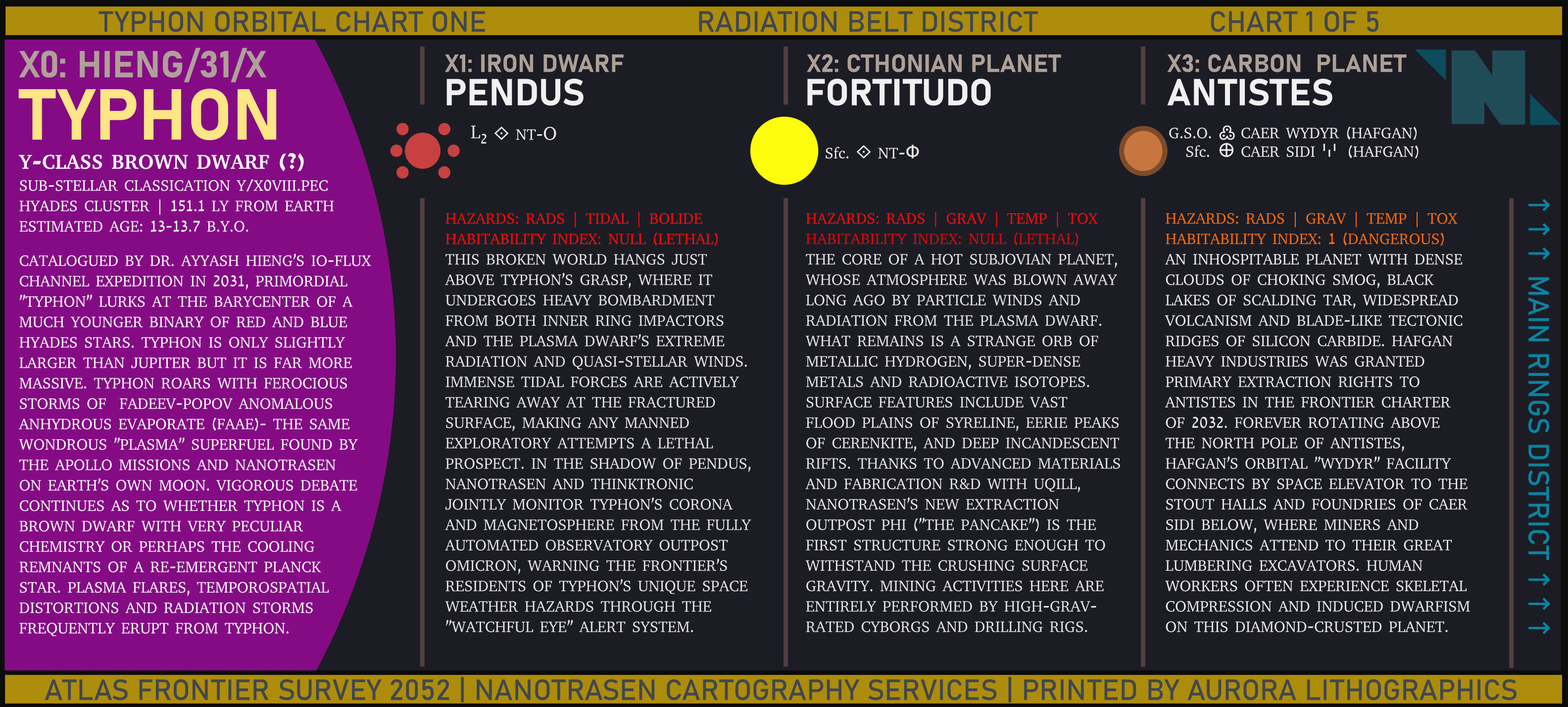
A map of the planets, moons, and other celestial bodies within SS13's planetary system, presented as an in-universe orbital chart. This is part 1 of 5, showing the Radiation Belt District. Notably, it also shows the the brown dwarf at the center of the planetary system SS13 is located in.
File history
Click on a date/time to view the file as it appeared at that time.
| Date/Time | Thumbnail | Dimensions | User | Comment | |
|---|---|---|---|---|---|
| current | 20:30, 6 October 2022 | | 3,168 × 1,428 (1.3 MB) | Cogwerks (talk | contribs) |
You cannot overwrite this file.
File usage
The following page uses this file: